Our Expertise
Five decades of integrated research and action in Kenya's arid and semi-arid lands
Our Mission
CETRAD assesses the potential of arid and semi-arid lands, empowers communities to manage their resources sustainably, and integrates sectoral actors for coordinated development. Through research, training, and data, we bridge science and action.
Areas of Expertise
01
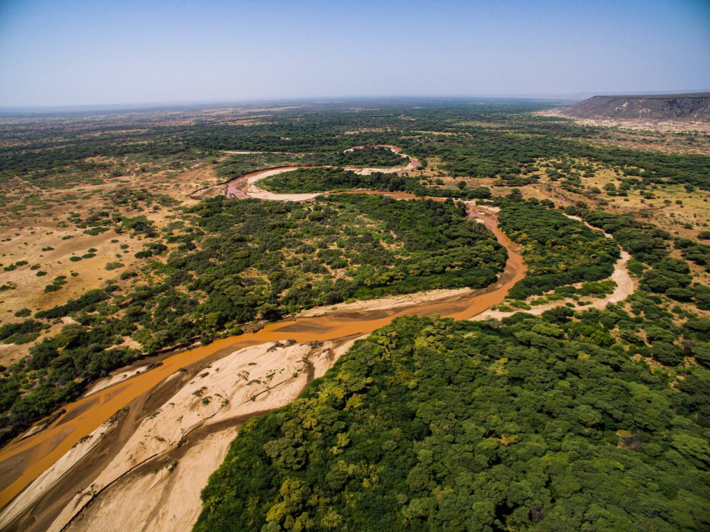
Water Resources & Hydrology
50-year hydromet dataset, integrated water resources management (IWRM), Water-Energy-Food nexus analysis, water user associations (WRUAs) support, and end-user water metering.
02
Geospatial Intelligence
GIS and remote sensing, spatial planning for counties, real-time environmental monitoring via LoRa network, GeoNetCast satellite data reception, and digital mapping.
03
Ecosystem Restoration
Wetland restoration, springs stewardship, invasive species management, wildlife corridor planning, and community-based natural resource governance.
04
Environmental Assessment
Environmental Impact Assessment (EIA), Strategic Environmental Assessment (SEA), sustainability assessment frameworks, and NEMA-certified auditing.
05
Conflict & Governance
Resource use conflict management, multi-stakeholder facilitation, participatory rural appraisal (PRA), and county-level policy advisory.
Who We Work With
National Government
Policy advisory, national monitoring frameworks, data for legislation, EIA support, and capacity building for ministries and agencies.
County Governments
County spatial planning, inventory of natural assets, water governance, WRUA support, sub-catchment management, and GIS capacity.
Donors & Development Partners
Baseline studies, M&E frameworks, applied research, knowledge products, and field implementation for bilateral and multilateral programmes.
Private Sector
Environmental Impact Assessment (NEMA-certified), CSR design and evaluation, baselines, GIS services, and staff training.
Research & Academic Partners
Research collaboration, access to 50-year hydromet dataset, postgraduate supervision and hosting, co-publication, and summer schools.
NGOs & Conservation Organizations
NRM planning, wetland and rangeland restoration, wildlife corridor mapping, resource conflict management, and community facilitation.
"We live here. 50 years of continuous presence in Laikipia has built deep community trust, long-term datasets, and institutional memory that shape everything we do."
What We Offer
GIS & Spatial Services
- - Land cover and use mapping, suitability analysis, terrain analysis
- - Drone mapping and surveys
- - Mobile data collection (KoBoToolbox, Survey123, ODK)
- - Geoportal and dashboard development
- - Enterprise GIS deployment (QGIS, ESRI, GeoNode)
- - Google Earth Engine and GeoAI
Water Resources & Environmental Monitoring
- - Hydromet network design, installation, and operation
- - IWRM planning and WRUA facilitation
- - Early warning system design
- - Sub-catchment and basin management plans
- - Hydro-ecological assessments
- - Access to 50-year Ewaso Ng'iro north basin dataset
Environmental Assessment
- - Environmental Impact Assessment (NEMA-certified)
- - Strategic Environmental Assessment (SEA)
- - Environmental audits
- - Sustainability assessment frameworks
- - Biodiversity monitoring
Natural Resource Management & Restoration
- - Wetland and riparian restoration
- - Rangeland restoration and management
- - Participatory NRM and conservation agriculture
- - Wildlife corridor mapping and securing
- - Resource conflict management
- - Participatory forest management
Research, Data & Knowledge
- - Baseline studies and impact evaluations
- - Field data collection and analysis
- - Policy briefs, articles, and data platforms
- - Research facilitation for external organisations
- - Postgraduate supervision and researcher hosting
- - Conference and symposium organisation
Training & Capacity Building
- - Food Security & Drought Management
- - GIS & Remote Sensing
- - Integrated Water Resources Management
- - Environmental Impact Assessment & Audit (NEMA certified)
- - Resource Use Conflict Management
- - Custom training for organisations and county governments